Alta Via dei Monti Liguri - The Green Balcony of Italy
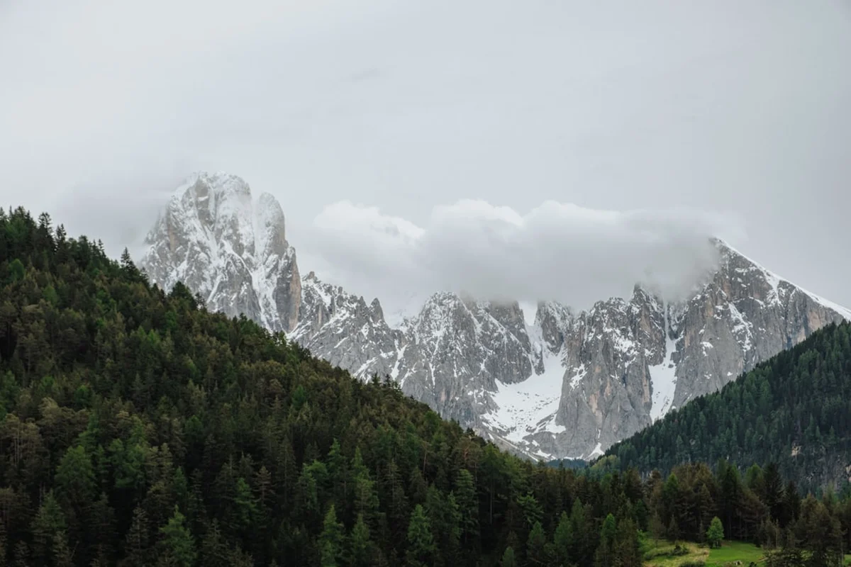
The Alta Via dei Monti Liguri (AVML) is one of Europe’s most spectacular and underrated long-distance thru-hikes, stretching approximately 440 kilometres across the entire length of the Ligurian arc. This "High Way" serves as a mountainous spine connecting the French border at Ventimiglia in the west to the Tuscan border at Ceparana in the east. It is a journey of immense geographical and cultural contrast, where hikers traverse the rugged Ligurian Alps before transitioning into the rolling, wind-swept ridges of the Ligurian Apennines. Throughout the journey, the trail maintains a constant dialogue between the mountains and the sea; on clear days, the shimmering Mediterranean remains a constant companion to the south, while the snow-capped peaks of the Central Alps and even the distant island of Corsica can be seen to the north and west.
Unlike the more famous Alpine routes, the Alta Via dei Monti Liguri offers a profound sense of solitude and a deep immersion into "Old Italy." The path winds through ancient beech forests, over limestone massifs, and across high-altitude pastures where traditional pastoralism still thrives. It passes through forgotten stone villages, medieval fortifications, and historical salt roads that once facilitated trade between the coast and the Po Valley. With a total elevation gain exceeding 20,000 metres, the AVML is a formidable physical challenge that requires endurance, navigational skill, and a spirit of adventure. It is not merely a hike; it is a 40-day odyssey through the soul of Liguria, far removed from the crowded beaches of the Italian Riviera.
- Distance: 440.0 km one-way
- Duration: 40–45 days (can be broken into shorter sections)
- Season: May to October (avoiding peak summer heat and winter snow)
- Accommodation: Rifugi (mountain huts), Posti Tappa (stage posts), and small village B&Bs
- Highest point: Monte Saccarello (2,201 m)
- Difficulty: Challenging (due to length, elevation, and occasional rugged terrain)
- Direction: Generally walked West to East (Ventimiglia to Ceparana)
Overview
The Alta Via dei Monti Liguri is often described as a "balcony over the sea." This description is literal; for much of its 440-kilometre length, the trail follows the watershed divide that separates the Mediterranean drainage from the Po River basin. This unique positioning creates a microclimate and a landscape found nowhere else in Italy. To the south, the land drops precipitously toward the glamorous coastal towns of Sanremo, Savona, Genoa, and the Cinque Terre. To the north, the mountains slope more gently toward the plains of Piedmont and Emilia-Romagna. The hiker stands on the narrow crest between these two worlds, experiencing the salty breeze of the sea and the crisp air of the mountains simultaneously.
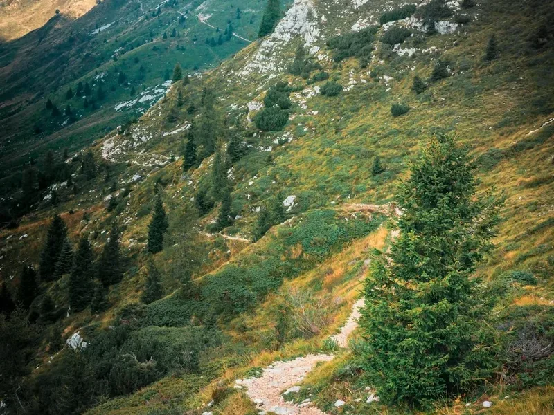
The trail is divided into 43 official stages, though most thru-hikers consolidate these based on fitness and accommodation availability. The western section, located in the Ligurian Alps, is the most alpine in character. Here, the trail reaches its highest elevations, crossing the limestone peaks of the Marguareis and Saccarello massifs. The terrain is rocky, dramatic, and demanding. As the trail moves eastward into the province of Savona and toward Genoa, the landscape softens into the Ligurian Apennines. Here, the peaks are lower—typically between 1,000 and 1,500 metres—but the ridges are exposed and subject to the "Macaia," a unique weather phenomenon where sea mist rolls over the ridges, creating an ethereal, atmospheric experience.
One of the most rewarding aspects of the AVML is the cultural transition. Hikers move from the Occitan-influenced valleys of the west to the heart of Genoese territory, and finally toward the Lunigiana region in the east. Each valley has its own dialect, its own culinary specialities (from the hearty "Cucina Bianca" of the Alps to the herb-rich pansoti of the east), and its own history. The trail is marked by the red-white-red "AV" symbol, but it remains a wild experience. Unlike the highly commercialised trails of the Dolomites, the AVML feels like a discovery. You will often walk for hours without seeing another soul, sharing the trail only with wild horses, chamois, and the occasional golden eagle circling above the ridges.
History and Cultural Context
The Alta Via dei Monti Liguri is a relatively modern creation with ancient foundations. The trail was officially established in 1983 through the collaboration of the Centro Studi Unioncamere Liguri and the Club Alpino Italiano (CAI). The goal was to create a unified route that would revitalise the inland mountain communities, which had suffered from depopulation as the coastal economy boomed. However, the paths that make up the AVML have been used for millennia. Many sections follow the "Vie del Sale" (Salt Roads), ancient trade routes used to transport salt—a precious commodity—from the coastal salt pans to the inland regions of Piedmont and Lombardy in exchange for grain, butter, and cheese.
The trail also bears the scars and monuments of Italy’s turbulent military history. Because the Ligurian ridges provided a natural defensive line, they were heavily fortified during the 18th and 19th centuries. Hikers will encounter massive stone forts, such as those in the Melogno Pass or the fortifications surrounding Genoa, which were designed to protect the Republic of Genoa and later the Kingdom of Sardinia from northern invasions. During World War II, these mountains were a stronghold for the Italian Resistance (Partisans). Many sections of the trail were used by partisan brigades to move undetected between valleys, and numerous small monuments along the route commemorate the skirmishes and sacrifices made in these heights.
Culturally, the AVML passes through the "Cucina Bianca" (White Cuisine) region in the west. This traditional diet was based on high-altitude products: flour, potatoes, leeks, garlic, and dairy products like "Bruss" (a fermented sheep's milk cheese). This was the food of the transhumance—the seasonal movement of people and livestock. As you move east, the influence of the sea becomes more apparent in the local culture, even in the mountains. The history of the AVML is the history of a resilient people who learned to survive in a vertical landscape, balancing the harshness of the mountains with the opportunities of the Mediterranean.
Want more background? Read extended notes on history and cultural context → Learn more
Seasonal Highlights and Weather Reality
Timing is critical when planning a thru-hike of the Alta Via dei Monti Liguri. Because the trail spans from sea level to over 2,200 metres, weather conditions can vary dramatically between the western and eastern ends. The primary window for a full thru-hike is from May to October, but each month offers a distinct experience.
Spring (May to June): This is arguably the most beautiful time to hike. The alpine meadows of the west are carpeted in wildflowers, including rare orchids, gentians, and the endemic Ligurian lily. The air is fresh, and the visibility is often excellent. However, hikers should be aware that snow can linger on the northern slopes of Monte Saccarello and the Marguareis massif until late May or even early June, potentially requiring an ice axe or micro-spikes for safe passage.
Summer (July to August): While the high-altitude sections in the west remain pleasant, the lower Apennine sections can become punishingly hot. Temperatures in the inland valleys can exceed 30°C, and the exposed ridges offer little shade. Water sources can also dry up during these months. If hiking in mid-summer, it is essential to start at dawn and carry significant water reserves. Afternoon thunderstorms are common and can be violent on the ridges.
Autumn (September to October): This is the "golden season" for the AVML. The summer heat dissipates, the air becomes exceptionally clear (offering the best views of Corsica), and the beech forests turn vibrant shades of orange and red. September is generally stable, but October can bring the "Alluvione" season—heavy Mediterranean rainstorms that can cause flash flooding and landslides. Always check the weather forecast for "Allerta Meteo" (weather alerts) during this period.
Winter (November to April): The AVML is not recommended as a thru-hike in winter unless you are an experienced winter mountaineer. The western sections are covered in deep snow and are prone to avalanches. Many rifugi and village accommodations close for the season. However, the lower sections near the coast can offer beautiful winter day hikes when the rest of Europe is under frost.
Recommended Itinerary
The 43-Stage Thru-Hike Breakdown
Section 1: The Ligurian Alps (Stages 1–9)
- Distance: Approx. 95 km
- Elevation: High alpine (up to 2,201 m)
- Key Waypoints: Ventimiglia, Dolceacqua, Monte Toraggio, Monte Saccarello, Colle di Nava
- Terrain: Steep limestone ridges, narrow balcony paths, and high-altitude meadows
- Highlights: The "Sentiero degli Alpini" (a spectacular path carved into the rock) and the summit of Monte Saccarello, the highest point in Liguria
- Note: This is the most physically demanding section with the greatest elevation changes
Section 2: The Savona Hinterland (Stages 10–18)
- Distance: Approx. 85 km
- Elevation: 800 m – 1,400 m
- Key Waypoints: Passo di Prale, Colle del Melogno, Bardineto, Calizzano
- Terrain: Dense beech and silver fir forests, rolling hills, and ancient military roads
- Highlights: The massive 19th-century fortifications at Melogno and the pristine forests of the Barbottina
- Note: The terrain becomes softer, but the stages are long and require good endurance
Section 3: The Beigua Massif and Genoa (Stages 19–27)
- Distance: Approx. 90 km
- Elevation: 500 m – 1,287 m
- Key Waypoints: Passo del Giovo, Monte Beigua, Passo del Turchino, Passo dei Giovi
- Terrain: Rocky plateaus (Beigua UNESCO Global Geopark), exposed ridges, and proximity to the city of Genoa
- Highlights: The "Lunar" landscape of Monte Beigua and the views over the Port of Genoa
- Note: This section is prone to the "Macaia" fog; navigation can be tricky in low visibility
Section 4: The Eastern Ridges and Vara Valley (Stages 28–36)
- Distance: Approx. 80 km
- Elevation: 600 m – 1,700 m
- Key Waypoints: Monte Antola, Barbagelata, Passo del Bocco, Monte Zatta
- Terrain: High Apennine ridges, ancient chestnut groves, and the spectacular beech forest of Monte Zatta
- Highlights: The summit of Monte Zatta, which offers a natural amphitheatre view of the coast
- Note: This area is remote; planning for food and water is essential
Section 5: The Gulf of Poets and the End (Stages 37–43)
- Distance: Approx. 90 km
- Elevation: 400 m – 1,000 m
- Key Waypoints: Passo del Bracco, Foce di Dosso, Bolano, Ceparana
- Terrain: Lower hills, Mediterranean macchia, and olive groves
- Highlights: The descent toward the Vara River and the views of the Apuan Alps in Tuscany
- Note: The trail ends in Ceparana, where you can take a bus to La Spezia for a celebratory meal by the sea
Important Notes:
- The AVML is marked with red-white-red paint and the letters "AV"
- Water is scarce on the ridges; always refill at village fountains (fontanelle)
- Wild camping is technically restricted but often tolerated if done discreetly and away from water sources (check local park regulations)
- The "Credenziale dell'Alta Via" (hiker's passport) can be used to get discounts in participating accommodations
- Mobile signal is intermittent on the ridges; download offline maps
Planning and Bookings
Book Your Trip
Everything you need to plan your journey
Accommodation
Find places to stay near Genoa
Flights
Search flights to Genoa
Essential Preparation
Thru-hiking the Alta Via dei Monti Liguri requires significant physical preparation and logistical planning. You should be comfortable walking 15–25 kilometres per day with a fully loaded pack (10–12 kg) over varied terrain. Training should include significant elevation gain and loss to prepare your knees for the steep descents common in the Ligurian Alps. Logistics are best managed by using Genoa as a central hub; the city is well-connected by rail and air, and it sits roughly at the midpoint of the trail, making it an ideal spot for a rest day or a gear resupply.
Before starting, it is highly recommended to join the Club Alpino Italiano (CAI). Membership provides insurance for mountain rescue (essential in Italy) and significant discounts on overnight stays and meals in CAI-affiliated rifugi. You should also obtain the official AVML maps (1:25,000 scale) or a reliable GPS app with offline capabilities, as trail markings can be faded or confusing at major junctions.
Trail Accommodation
Accommodation on the AVML is a mix of mountain huts (rifugi), dedicated stage posts (posti tappa), and small hotels or B&Bs in the villages the trail passes through. Unlike the Appalachian Trail or the PCT, there are no "shelters" or "lean-tos."
Rifugi and Posti Tappa:
- Facilities: Usually provide a bunk in a dormitory, shared bathrooms, and a communal dining area. Half-board (dinner, bed, and breakfast) is the standard and most economical option.
- Booking: Essential, especially on weekends and during July/August. Most bookings are done via phone or email directly with the host.
- Costs: Expect to pay €45–€65 for half-board. CAI members receive a discount of approximately 20–30% in CAI huts.
- Availability: Most high-altitude rifugi are open from mid-June to mid-September. Posti tappa in lower villages may be open year-round.
What is NOT provided:
- Bed linen: You must carry a lightweight sleeping bag liner (sacco lenzuolo). Blankets are usually provided.
- Toiletries: Bring your own soap, towel, and toilet paper.
- Electricity: Charging points are limited; bring a power bank.
- WiFi: Rarely available in mountain huts; mobile data is your best bet.
Required Gear
- Footwear: Sturdy trekking boots with good ankle support and Vibram soles. The terrain is often rocky and abrasive.
- Backpack: 40–50 litre capacity with a high-quality suspension system and rain cover.
- Clothing: Layering system (merino base layers, fleece mid-layer, lightweight down jacket for evenings).
- Rain Gear: High-quality waterproof jacket (Gore-Tex or similar) and overtrousers. Ligurian storms are intense.
- Navigation: Physical maps (Stages 1–43), compass, and a GPS device or smartphone with the "Alta Via Info H24" app.
- Trekking Poles: Highly recommended to save your knees on the 20,000 m of descent.
- Emergency Gear: Whistle, space blanket, and a basic multi-tool.
What to Bring
- Water Treatment: A lightweight filter (like a Sawyer Squeeze) or purification tablets. While village fountains are usually safe, mountain streams may be contaminated by livestock.
- First Aid Kit: Focus on blister care (Compeed), antiseptic wipes, painkillers, and any personal medications.
- Sun Protection: SPF 50+ sunscreen, lip balm with UV protection, and a wide-brimmed hat. The ridges are extremely exposed.
- Food: Carry 1–2 days of emergency rations (energy bars, nuts, dried fruit). You can buy lunch supplies (focaccia, cheese, fruit) in the villages you pass through.
- Cash: Many small rifugi and village shops do not accept credit cards. Carry enough Euros to cover at least 3–4 days of expenses.
- Hiker's Passport: The "Credenziale" to collect stamps and access discounts.
Permits
One of the great joys of the Alta Via dei Monti Liguri is the lack of bureaucratic hurdles. No permits are required to walk the trail, and there are no daily quotas or entry fees for the regional parks it traverses (such as the Parco delle Alpi Liguri or the Parco del Beigua). The trail is open to everyone at all times.
Accommodation Bookings: While no trail permit is needed, your "permits" are essentially your accommodation reservations. During the peak months of July and August, and on any weekend with good weather, the rifugi can fill up completely with local hikers. It is wise to book at least 2–3 days in advance as you move along the trail. If you are a large group (4+ people), you should book several weeks in advance.
Wild Camping Regulations: In Italy, wild camping (camping outside of designated sites) is generally prohibited, especially in National and Regional Parks. However, "bivouacking" (setting up a tent at sunset and taking it down at sunrise) is often tolerated in remote areas of the AVML, provided you are not near a rifugio or a private dwelling. In the Parco del Beigua and Parco dell'Aveto, regulations are stricter; always check the specific park website for the most current rules. Never light fires, as the risk of wildfire in Liguria is extremely high.
The Credenziale: While not a permit, the "Credenziale dell'Alta Via dei Monti Liguri" is a document that identifies you as a thru-hiker. It can be purchased at CAI offices in Genoa or Ventimiglia, or ordered online. It allows you to collect stamps (timbri) at each stage, providing a wonderful souvenir of your journey and occasionally granting access to "hiker rates" in local hostels.
Other Activities in the Area
Liguria is a narrow strip of land where the mountains meet the sea, meaning you are never more than a few hours away from the coast. Consider these activities to complement your hike:
- Genoa's Old Town: Spend a rest day in the "Caruggi" (narrow alleys) of Genoa, a UNESCO World Heritage site. Visit the Aquarium, the largest in Europe, and eat authentic Pesto Genovese in its city of origin.
- Cinque Terre Detour: From the eastern end of the AVML, it is a short train ride to the five famous villages of Monterosso, Vernazza, Corniglia, Manarola, and Riomaggiore. You can hike the coastal "Sentiero Azzurro" for a completely different perspective.
- Whale Watching: The waters off the Ligurian coast are part of the Pelagos Sanctuary for Mediterranean Marine Mammals. Boat tours from Genoa or Savona offer the chance to see fin whales, sperm whales, and dolphins.
- Rock Climbing in Finale Ligure: If you have energy left, Finale Ligure is one of the world's premier limestone climbing destinations, located just south of the AVML's central section.
- Olive Oil Tasting: The western valleys (especially around Imperia) produce some of the world's finest Taggiasca olive oil. Many "agriturismi" along the trail offer tastings and tours of their groves.
Safety and Conditions
Navigation and Visibility: The greatest safety hazard on the AVML is not the terrain, but the weather—specifically fog. The "Macaia" can reduce visibility to less than five metres in a matter of minutes. On the exposed ridges of the Beigua or the Antola, it is incredibly easy to lose the trail. Always carry a compass and a GPS with offline maps. If you lose the trail in the fog, do not wander; stay put or backtrack carefully to the last known marker.
Water Scarcity: Liguria is a karst landscape in many areas, meaning water disappears into the ground. During a dry summer, stretches of 20 kilometres or more may have no reliable water sources. Never pass a village fountain without topping up your bottles. Aim to carry at least 3 litres during the summer months.
Wildlife: The mountains are home to wild boars (cinghiali), which are generally shy but can be aggressive if they have young or feel cornered. Keep your distance. Ticks are also prevalent in the lower, grassy sections and the chestnut forests; perform a tick check every evening. In the western Alps, wolves have returned; while they pose no threat to humans, they are a reason to keep dogs on a lead.
Emergency Services: The emergency number in Italy is 112. If you require mountain rescue, ask for "Soccorso Alpino." Be prepared to provide your coordinates and a description of your surroundings. Because the trail is often on the border between provinces, your call may be routed to different dispatch centres; remain calm and clear.
Heatstroke and Hypothermia: On the same day, you can experience 30°C heat in a valley and a 5°C wind chill on a ridge. Proper layering and hydration are your best defences. Know the signs of heat exhaustion (dizziness, heavy sweating, rapid pulse) and take breaks in the shade whenever possible.
Side Trips and Points of Interest
Monte Saccarello (2,201 m): The highest point of the trail and of the entire Ligurian region. At the summit stands a massive bronze statue of the Redeemer, erected in 1901. The views from here are unparalleled, stretching from the French Riviera to the peaks of the Ecrins and the Matterhorn on a clear day. It is a place of profound silence and majesty.
The Ghost Village of Balestrino: A short detour from the trail in the Savona section leads to the abandoned village of Balestrino. Evacuated in the 1960s due to hydrogeological instability, the medieval castle and stone houses remain frozen in time, slowly being reclaimed by the forest. It is a hauntingly beautiful example of the "abandoned Italy" that the AVML seeks to highlight.
The Forts of Genoa: As the trail passes behind the city of Genoa, it weaves through a complex system of 18th and 19th-century fortifications, including Forte Sperone and Forte Diamante. These massive stone structures are some of the largest defensive works in Europe and offer a fascinating look into the military engineering of the era, as well as stunning views of the city and the sea below.
Monte Zatta Beech Forest: Located in the eastern section, the forest of Monte Zatta is considered one of the most beautiful in Italy. The ancient beech trees grow in a "cathedral" formation, with high canopies and a clear forest floor. The trail follows the crest of the mountain, which forms a natural horseshoe shape, providing a unique 270-degree view of the Gulf of Tigullio.
Leave No Trace
The Alta Via dei Monti Liguri passes through several fragile ecosystems, including UNESCO Global Geoparks and Regional Natural Parks. As a hiker, you are a guest in these protected areas. The survival of the trail and the hospitality of the local communities depend on hikers respecting the environment.
The Seven Principles on the AVML:
- Plan Ahead and Prepare: Know the weather and your limits. Avoid calling for rescue due to poor planning, which strains local resources.
- Travel and Camp on Durable Surfaces: Stay on the marked "AV" path. The limestone soils and alpine meadows are easily eroded.
- Dispose of Waste Properly: Pack out everything. This includes fruit peels and nut shells, which do not decompose quickly in the dry Mediterranean climate. Carry a small trowel for human waste and ensure you are at least 60 metres from any water source.
- Leave What You Find: Do not pick wildflowers or remove rocks. Many plants in the Ligurian Alps are rare endemics.
- Minimise Campfire Impacts: Fires are strictly prohibited. Liguria is extremely prone to wildfires, which can devastate the landscape and threaten villages. Use a lightweight camping stove only.
- Respect Wildlife: Observe from a distance. Do not feed animals, as this habituates them to humans and can lead to dangerous encounters (especially with wild boars).
- Be Considerate of Others: Keep noise levels down. Many people live and work in these mountains; respect their privacy and their livestock.