Alacam Mountains Trail - A Journey Through Anatolian Highlands
The Alacam Mountains Trail is a captivating multi-day trek traversing the rugged and remote Alacam Mountains in northern Turkey, offering a profound immersion into Anatolian wilderness. This challenging 75.0 km route unfolds over 4 to 5 days, ascending through diverse landscapes from verdant valleys to windswept alpine plateaus. It is a journey that rewards the determined with breathtaking vistas, encounters with unique flora and fauna, and a deep sense of accomplishment. The trail is best experienced between June and September, when the weather is most favourable for high-altitude trekking. Its remoteness ensures a genuine escape from the everyday, providing a rare opportunity to connect with nature in its purest form.
- Distance: 75.0 km one-way
- Duration: 4–5 days
- Season: June to September
- Difficulty: Challenging
- Highest point: Approximately 2,500 m
- Closest City: Samsun
- Trailhead Access: Nearest city: Samsun. From Samsun, take a bus to Yakakent (approx. 2 hours). From Yakakent, a taxi or dolmuş (shared minibus) can reach the trailhead (approx. 30 minutes). Road conditions are generally good, but may be rough near the trailhead. Limited parking available. No permits required.
Overview
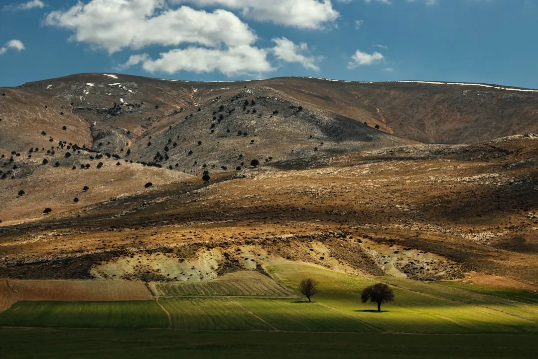
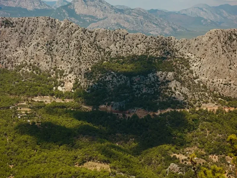
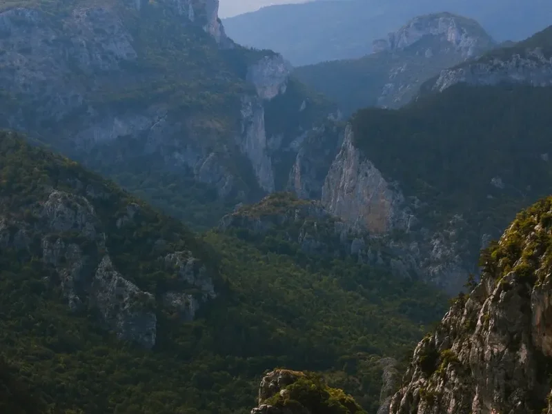
The Alacam Mountains Trail is a testament to the wild beauty of Turkey's northern highlands. Unlike more manicured European or New Zealand trails, this route offers a raw, untamed experience. The journey begins with a gradual ascent through rolling foothills, gradually giving way to steeper, more demanding terrain as you climb into the heart of the Alacam range. Expect a dramatic shift in scenery as you transition from mixed forests of pine and oak to open alpine meadows dotted with wildflowers in the summer months. The air is crisp and clean, carrying the scent of pine and damp earth.
The trail's challenging nature stems from its significant elevation gain of 2,500 metres spread across its 75 km length. This means sustained climbs and descents, requiring good physical fitness and mental fortitude. However, the rewards are immense. From the higher reaches of the Alacam Mountains, panoramic views stretch across vast, undulating landscapes, revealing distant peaks, deep valleys, and, on clear days, the shimmering expanse of the Black Sea. The sense of solitude is profound; you are unlikely to encounter many other hikers, making this a truly immersive wilderness experience.
The trail is not formally marked with the same intensity as some international Great Walks, demanding a higher degree of self-reliance in navigation. This adds to the adventure, encouraging a deeper connection with the environment. The Alacam Mountains are a biodiversity hotspot, home to various species of mountain goats, birds of prey, and a rich array of alpine flora. The changing light throughout the day paints the mountains in a spectrum of colours, from the soft pastels of dawn to the fiery hues of sunset. This trail is for the adventurer seeking an authentic, challenging, and visually spectacular trek in a less-travelled corner of the world.
History and Cultural Context
The Alacam Mountains, like much of Anatolia, possess a rich and layered history, though specific documented records of human passage along this particular trail are scarce. The region has been a crossroads of civilizations for millennia, with evidence of Hittite, Roman, Byzantine, and Ottoman presence in the broader geographical area. The Alacam Mountains themselves likely served as seasonal grazing grounds for nomadic and semi-nomadic peoples for centuries, their routes dictated by the availability of pasture and the changing seasons.
The name "Alacam" itself is derived from Turkish words relating to pine trees, suggesting a long-standing recognition of the dominant forest cover in the region. The traditional use of these mountains for pastoralism means that rudimentary tracks, used by shepherds and their flocks, have existed for generations. These ancient pathways, often following natural contours and water sources, form the basis of many modern hiking routes in the area, including sections of the Alacam Mountains Trail.
In more recent history, the Alacam Mountains have remained a relatively undeveloped and sparsely populated region. This remoteness has helped preserve its natural character and traditional way of life in the surrounding villages. While there may not be grand historical monuments directly on the trail, the landscape itself tells a story of resilience, adaptation, and the enduring relationship between people and the mountain environment. Understanding this context adds a deeper dimension to the trekking experience, connecting the walker to the ancient rhythms of the land and its people.
Seasonal Highlights and Weather Reality
The Alacam Mountains Trail is a high-altitude trek, and its accessibility and character are heavily influenced by the seasons. The optimal window for hiking is from June to September, offering the most stable and pleasant weather conditions.
Spring (April-May): While the lower slopes may begin to green, higher elevations can still be snow-covered. Rivers and streams will be swollen with snowmelt, making crossings potentially hazardous. The weather is highly unpredictable, with a risk of late snowfalls and cold temperatures. This season is generally not recommended for the full trail.
Summer (June-August): This is the prime hiking season. Days are generally long and sunny, with temperatures in the lower and mid-altitudes typically ranging from 15°C to 25°C. Alpine meadows burst into bloom with a vibrant array of wildflowers, creating stunning visual displays. However, summer can also bring afternoon thunderstorms, particularly in the mountains. Temperatures at higher altitudes can still drop significantly overnight, and it is essential to be prepared for cold conditions, especially at elevations around 2,000 metres and above. Sandflies are generally not a significant issue in this region.
Autumn (September-October): September often offers crisp, clear days with cooler temperatures, making for excellent hiking. The autumn colours can be spectacular, with foliage turning shades of gold and red. However, as October progresses, the risk of early snowfalls increases, and temperatures will drop considerably. The days become shorter, and the weather can become more unsettled.
Winter (November-March): The Alacam Mountains are typically covered in deep snow during winter, making the trail impassable and dangerous for hikers. Temperatures will be well below freezing, and conditions will be harsh. This season is strictly for experienced winter mountaineers with appropriate gear and expertise.
Weather Considerations: Regardless of the season, mountain weather is notoriously fickle. Be prepared for rapid changes, including sudden drops in temperature, strong winds, and precipitation (rain or snow). Always check the forecast before you depart and be ready to adapt your plans.
Recommended Itinerary
4-Day Alacam Mountains Trail Itinerary
Day 1: Yakakent to First Mountain Camp
- Distance: 15 km
- Elevation gain: 700 m
- Time: 5–6 hours
- Start from the trailhead near Yakakent, accessible by taxi or dolmuş from Samsun.
- Begin with a moderate ascent through mixed forests of pine and oak.
- The trail gradually steepens, offering glimpses of the surrounding valleys.
- Reach a suitable camping spot at approximately 1,500 m elevation, offering initial mountain views.
- Set up camp and enjoy the first night under the stars.
Day 2: First Mountain Camp to Alacam Plateau
- Distance: 20 km
- Elevation gain: 900 m
- Time: 7–8 hours
- Continue climbing, leaving the tree line behind as you enter alpine meadows.
- The terrain becomes more rugged and exposed.
- Pass through areas known for their diverse wildflowers (in season).
- Reach the Alacam Plateau, a vast, relatively flat expanse at around 2,400 m.
- Find a sheltered camping spot on the plateau, offering expansive 360-degree views.
- This is a demanding day with significant elevation gain.
Day 3: Alacam Plateau Exploration and Descent to Lower Camp
- Distance: 18 km
- Elevation gain: 200 m (exploration), 800 m descent
- Time: 6–7 hours
- Spend the morning exploring the high plateau, perhaps reaching a nearby peak for sunrise views.
- Begin the descent from the plateau, following a different route to vary the scenery.
- The descent is steep in sections, requiring careful footing.
- Descend back into the forested zone to find a suitable camping location at a lower elevation (approx. 1,600 m).
- This day offers a mix of high-altitude exploration and a significant descent.
Day 4: Lower Camp to Yakakent Trailhead
- Distance: 22 km
- Elevation gain: 100 m (minor ups and downs), 700 m descent
- Time: 6–7 hours
- A longer day, primarily consisting of descent back towards the trailhead.
- Follow established paths through forests and open country.
- The trail may pass through small, traditional villages where you might be able to resupply water or interact with locals.
- Arrive back at the trailhead near Yakakent.
- Arrange for taxi or dolmuş transport back to Samsun.
Important Notes:
- This itinerary is a suggestion and can be adapted based on fitness levels and weather conditions.
- Camping is wild camping; no designated campsites or huts are available.
- Water sources can be scarce at higher elevations; carry sufficient water or a reliable purification method.
- Navigation skills are essential as the trail is not always clearly marked.
- Be prepared for significant temperature fluctuations between day and night.
Planning and Bookings
Book Your Trip
Everything you need to plan your journey
Accommodation
Find places to stay near Samsun
Flights
Search flights to Samsun
Essential Preparation
The Alacam Mountains Trail is a remote and challenging trek that requires thorough preparation. Unlike more developed trails, there are no established booking systems for accommodation or permits. The primary focus of your planning will be logistics, gear, and self-sufficiency. Your closest major city is Samsun, which will serve as your gateway. From Samsun, you will need to arrange transport to the trailhead near Yakakent. This typically involves a bus journey of approximately two hours, followed by a shorter taxi or dolmuş ride to the actual starting point of the trail. It is advisable to confirm transport options in advance, especially if travelling during off-peak times. Road conditions to the trailhead can be variable, so a robust vehicle or a reliable local driver is recommended. Given the remoteness, carrying all necessary food, water treatment supplies, and a comprehensive first-aid kit is paramount. Informing someone of your itinerary and expected return date is a crucial safety measure.
Trail Accommodation
This is a wild camping trek. There are no huts, lodges, or designated campsites along the Alacam Mountains Trail. Walkers are expected to be self-sufficient and carry their own camping equipment. You will need to identify suitable, safe, and environmentally responsible locations to pitch your tent each night. This typically involves finding flat, sheltered spots away from watercourses and potential rockfall zones. The itinerary suggests camping locations at approximately 1,500 m on Day 1, on the Alacam Plateau at around 2,400 m on Day 2, and at a lower elevation of 1,600 m on Day 3. These are general guidelines; actual camping spots will depend on terrain, water availability, and weather conditions. Ensure you are familiar with Leave No Trace principles for wild camping.
This is a day hike requiring no overnight accommodation.
Required Gear
- Sturdy hiking boots: Waterproof, well-broken-in boots with good ankle support are essential for navigating varied and often rough terrain.
- Backpack: A comfortable and robust backpack of 50-70 litres capacity, with a rain cover, is necessary to carry all your gear and supplies.
- Tent: A lightweight, durable, and waterproof three-season tent suitable for mountain conditions.
- Sleeping bag: A warm sleeping bag rated for temperatures down to 0°C or below, as nights at higher altitudes can be cold.
- Sleeping mat: For insulation and comfort.
- Waterproof jacket and trousers: High-quality, breathable waterproofs are non-negotiable due to the potential for sudden mountain weather changes.
- Warm layers: Including a fleece or down jacket, thermal base layers (merino wool or synthetic), and a warm hat and gloves.
- Navigation tools: A reliable GPS device or smartphone with offline maps, a compass, and a detailed map of the region. Knowledge of how to use them is critical.
- Head torch: With spare batteries, for use in camp and during early morning or late evening travel.
- First-aid kit: Comprehensive, including blister treatment, pain relievers, antiseptic wipes, bandages, and any personal medications.
- Sun protection: High SPF sunscreen, sunglasses, and a wide-brimmed hat, as the sun can be intense at altitude.
- Trekking poles: Highly recommended for stability on ascents and descents, and to reduce strain on joints.
What to Bring
- Food: Sufficient non-perishable food for 4-5 days, including breakfasts, lunches, dinners, and high-energy snacks. Lightweight, calorie-dense options are best.
- Water treatment: A water filter or purification tablets are essential, as water sources may be unreliable or require treatment.
- Cooking equipment: A lightweight camping stove, fuel, a cooking pot, utensils, and a mug.
- Toiletries: Biodegradable soap, toothbrush, toothpaste, toilet paper, hand sanitiser, and any personal hygiene items. Pack out all used toilet paper.
- Repair kit: Duct tape, cordage, needle and thread, and a multi-tool for minor gear repairs.
- Personal items: Camera, power bank for electronics, book or journal for downtime.
- Cash: Some Turkish Lira for potential use in villages or for transport.
- Whistle: For emergency signalling.
Permits
No specific permits are required to hike the Alacam Mountains Trail. The region is largely undeveloped and not part of a strictly managed national park system that mandates permits for independent trekkers. However, this lack of formal regulation underscores the importance of self-reliance and responsible outdoor practices. While you do not need to book accommodation or obtain official permission, it is highly advisable to inform local authorities or a trusted contact in Samsun or Yakakent of your intended route and expected return date. This is a safety precaution in case of emergencies. Always respect the land and local customs, and practice Leave No Trace principles diligently, as you are essentially entering a wild and natural environment.
Other Activities in the Area
While the Alacam Mountains Trail offers a primary focus on trekking, the surrounding region and the city of Samsun provide additional opportunities for exploration and cultural immersion:
- Explore Samsun: As a major Black Sea port city, Samsun offers a vibrant urban experience. Visit the Samsun Archaeology and Ethnography Museum to learn about the region's history, stroll along the waterfront promenade, or explore the Atatürk Monument and the Bandırma Ferry Museum, commemorating Mustafa Kemal Atatürk's pivotal journey that began the Turkish War of Independence.
- Black Sea Coastline: The Alacam Mountains are relatively close to the Black Sea coast. Day trips or extensions can allow for visits to coastal towns, beaches, and enjoying fresh seafood.
- Local Villages: The villages surrounding the Alacam Mountains offer a glimpse into traditional Anatolian rural life. Interacting with locals (respectfully, and perhaps with a translator if possible) can provide insights into their culture, agriculture, and way of life.
- Nature Reserves: Depending on the specific location and accessibility, there may be other smaller nature reserves or protected areas in the wider Alacam region that offer different hiking or wildlife viewing opportunities. Research local conservation efforts for potential points of interest.
- Culinary Experiences: Sample the local cuisine of the Black Sea region, known for its corn-based dishes, fresh fish, and unique regional specialities.
Safety and Conditions
Pre-Trip Planning:
- Weather Monitoring: Check reliable weather forecasts for the Alacam Mountains region before and during your trek. Mountain weather can change rapidly and dramatically.
- Route Familiarisation: Study maps and GPS data thoroughly. Understand the terrain, potential water sources, and possible escape routes.
- Inform Someone: Leave a detailed itinerary, including your planned route, expected duration, and emergency contact information, with a reliable person in Samsun or Yakakent.
- Emergency Contacts: Have local emergency numbers readily available (e.g., Gendarmerie, Ambulance).
On the Trail:
- Navigation: This is a challenging trail with potentially unclear markings. A GPS device or smartphone with offline maps and a compass are essential. Do not rely solely on one navigation method.
- Water: Water sources can be intermittent, especially at higher altitudes during dry periods. Always carry sufficient water and use a reliable water filter or purification tablets for any water collected from streams or springs.
- Terrain: Be prepared for steep ascents and descents, loose scree, rocky sections, and potentially overgrown paths. Trekking poles are highly recommended for stability and to reduce impact on joints.
- Wildlife: While large dangerous animals are uncommon, be aware of your surroundings. Respect any wildlife you encounter and maintain a safe distance.
- Altitude: The trail reaches elevations of up to 2,500 metres. Be aware of the symptoms of altitude sickness (headache, nausea, dizziness) and descend if symptoms worsen. Acclimatise gradually if possible.
- Hypothermia: Even in summer, temperatures at higher altitudes can drop significantly, especially at night or during bad weather. Carry warm, layered clothing and be prepared for cold conditions.
- Communication: Mobile phone signal is likely to be non-existent for most of the trail. Consider carrying a personal locator beacon (PLB) or satellite messenger for emergencies.
- First Aid: Be prepared to handle minor injuries and ailments yourself. A comprehensive first-aid kit and knowledge of its use are vital.
General Safety: Always hike with at least one other person if possible. Let someone know your plans. Be conservative with your daily mileage and allow for unexpected delays due to weather or terrain.
Side Trips and Points of Interest
Alacam Plateau Summit: While the main trail traverses the Alacam Plateau, there are often higher, unnamed peaks or prominent viewpoints accessible from the plateau itself. A short, steep scramble from the main camping area on Day 3 can lead to a summit offering truly spectacular 360-degree panoramas of the entire Alacam mountain range and the distant Black Sea coastline on a clear day. This is an excellent opportunity for sunrise or sunset photography.
Hidden Valleys and Waterfalls: As you descend from the plateau on Day 3 and on the final day's trek, keep an eye out for smaller, less-travelled side valleys. These may contain hidden streams, small cascades, or unique rock formations that are not part of the main trail but offer opportunities for quiet exploration and discovery. Always assess safety and terrain before venturing off the main path.
Traditional Villages: Depending on the exact route taken, the descent on Day 4 might pass close to small, traditional mountain villages. These settlements, often characterised by stone houses and terraced fields, offer a glimpse into a way of life that has changed little over generations. If you encounter villagers, a respectful greeting and a smile can go a long way. Be mindful of private property and local customs.
Flora and Fauna Observation: The Alacam Mountains are rich in biodiversity. Keep an eye out for mountain goats (Capra aegagrus) on the higher slopes, various species of birds of prey soaring overhead, and a diverse array of alpine wildflowers, particularly in the meadows during the summer months. The forests are home to pine trees, oaks, and a variety of shrubs and smaller plants.
Leave No Trace
The Alacam Mountains Trail traverses a pristine natural environment that is largely untouched by human development. To preserve its beauty and ecological integrity for future generations, it is imperative that all hikers adhere to the principles of Leave No Trace (LNT).
Your responsibility as a hiker:
- Plan Ahead and Prepare: Research the trail thoroughly, understand the conditions, and pack appropriately. Know the local regulations regarding camping and fires (fires are generally discouraged or prohibited in wild areas).
- Travel and Camp on Durable Surfaces: Stick to established paths where they exist. When camping, choose established or resilient sites. Avoid camping on fragile vegetation or near water sources. Pitch your tent on bare ground or rock if possible.
- Dispose of Waste Properly: Pack out everything you pack in, including all food scraps, wrappers, and any other litter. This includes used toilet paper; carry it out in a sealed bag. Use designated toilet facilities if available, or dig catholes at least 60 metres away from water, trails, and campsites.
- Leave What You Find: Do not disturb or remove natural objects such as rocks, plants, or cultural artefacts. Take only photographs and memories.
- Minimise Campfire Impacts: Campfires can cause lasting damage. If permitted and absolutely necessary, use a lightweight stove for cooking. If a campfire is essential, use existing fire rings and keep fires small. Ensure fires are completely extinguished and cold before leaving.
- Respect Wildlife: Observe wildlife from a distance. Never feed animals, as this can disrupt their natural behaviours and diets, and can be harmful to their health. Store food securely to prevent attracting animals.
- Be Considerate of Other Visitors: While this trail is remote, you may encounter other hikers or local people. Keep noise levels down, yield to others on the trail, and be respectful of their experience.
By following these principles, you help ensure that the Alacam Mountains remain a wild and beautiful place for all to enjoy.